CALL NOW For Introductory 25% Discount Offer on Herd Surveys • (218) 821-5692

Deer Herd Surveys
Accurate Population Count and Buck/Doe Ratio
OUR SERVICES
RPM offers aerial imaging services for a variety of applications. Our thermal drones have the unique ability to track wounded or lost game and pets, as well as monitoring heat loss sources on commercial buildings and rental units. Our high-resolution photo/video drones can create cinema quality landscape footage as well as high-detail property maps.
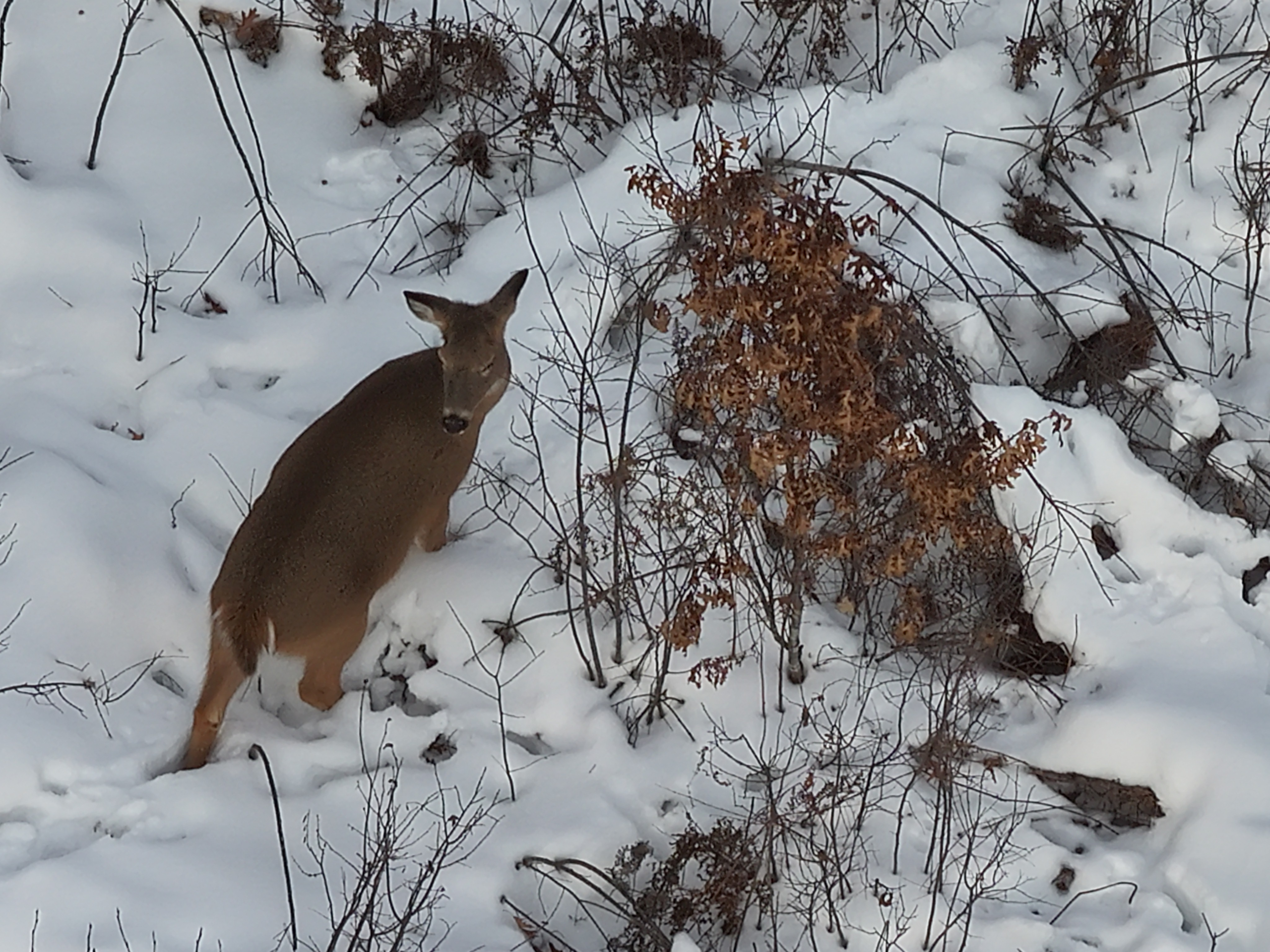
Herd Surveys
A deer herd survey will give you an accurate assessment of your deer population and buck/doe ratios. This data is extremely valuable for how you manage the population to grow bigger target bucks and an overall higher quality of deer who utilize your property.
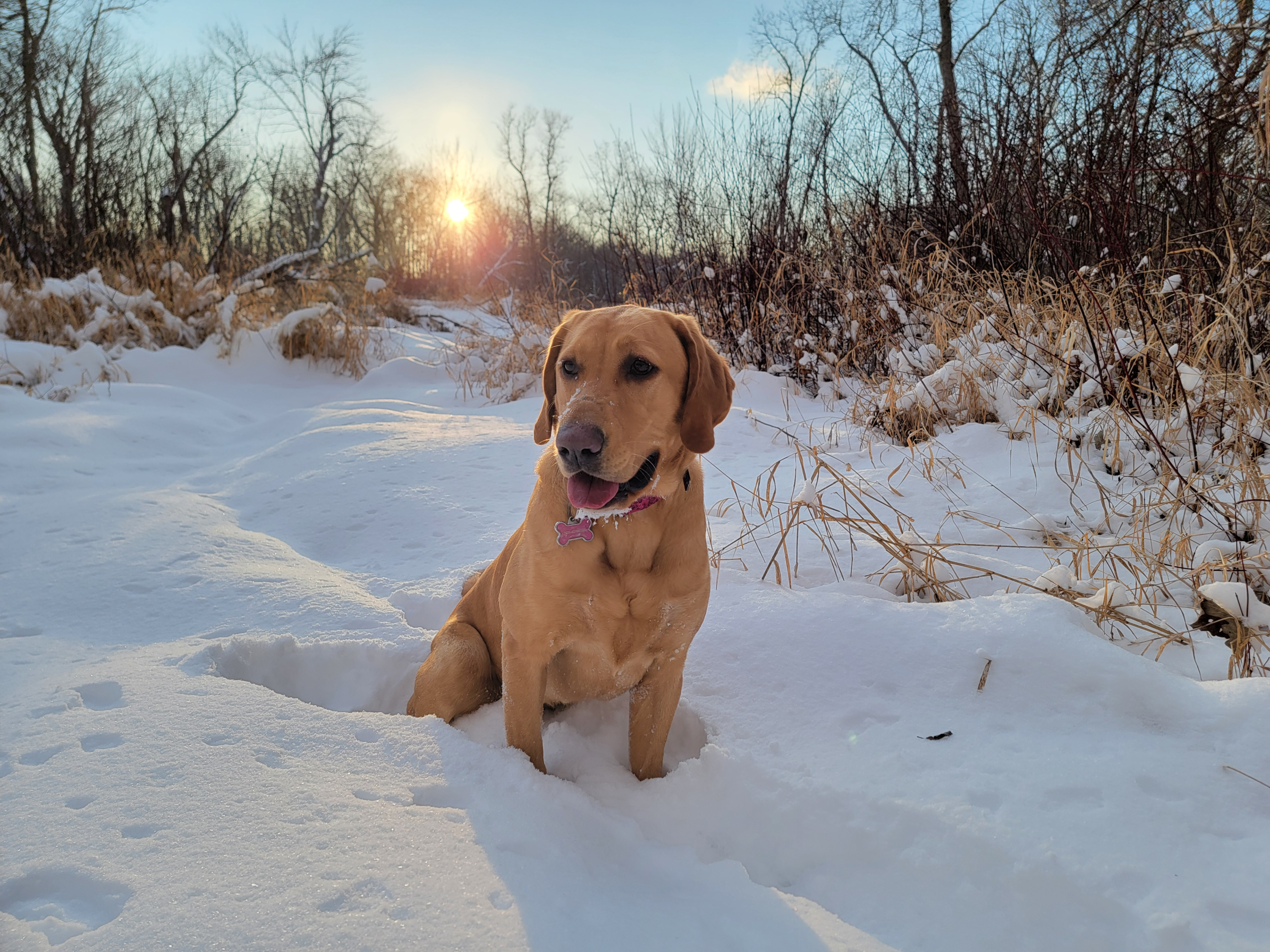
Deer/Pet Recovery
As avid hunters and pet owners we understand the importance of putting every possible effort into ethically dispatching and recovering your target game. When it comes to finding a wounded deer or, in the worst case, a family pet, we treat each and every search as if it were our own.
Real Estate Imagery
With years of experience capturing drone footage in the action sports industry, we can easily accommodate your needs to deliver that extra touch when presenting your next residential, lakeshore, agricultural or recreational property.
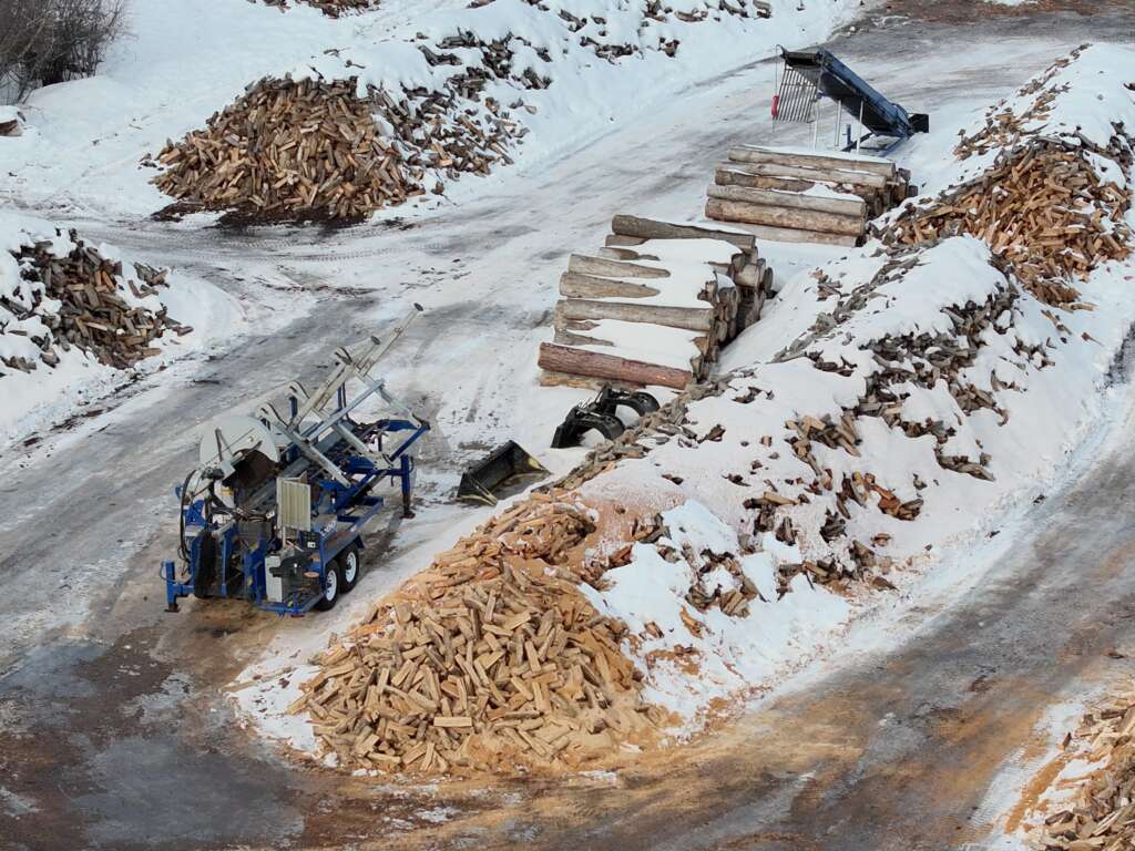
Site Mapping/Surveys
By utilizing high-resolution drone cameras and photogrammetry software we can deliver digital and printed aerial maps with 3D-like detail. Aerial mapping is also very useful for work flow design and monitoring of materials such as logs, sand & gravel.